Detail Cantuman
Advanced Search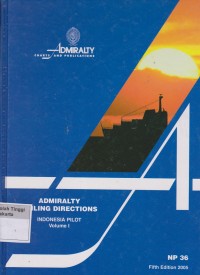
Text
Admiralty Sailing Directions Indonesia Pilot Volume I : West Coast of Jawa, the north coast of Jawa eastwards to Tanjung Bendoh South and east coasts of Sumatera Selat Sunda, Selat Bangka, Selas Gelasa, Selat Karimata. South and west coasts of Kalimantan from Tanjung Puting to Pulau Pontianak Pulau-pulau Badas and Tambelan, Pulau-pulau Lingga and Riau, with the various routes leading to Singapore and South China Sea
- Bagikan:


Tidak Tersedia Deskripsi
Ketersediaan
| N1264 | 623.89 ADM a | Perpustakaan Sekolah Tinggi Maritim Yogyakarta (RAK D3 Studi Nautika) | Tersedia |
| N1921 | 623.89 WIL a | Perpustakaan Sekolah Tinggi Maritim Yogyakarta (RAK D3 Studi Nautika) | Tersedia |
Informasi Detil
| Judul Seri |
-
|
|---|---|
| No. Panggil |
623.9 WIL a
|
| Penerbit | The United Kingdom Hydrographic Office : London., 2009 |
| Deskripsi Fisik |
xvi, 238 hlm. ; index ; 28 cm
|
| Bahasa |
English
|
| ISBN/ISSN |
-
|
| Klasifikasi |
623.9 WIL a
|
| Tipe Isi |
-
|
| Tipe Media |
-
|
|---|---|
| Tipe Pembawa |
-
|
| Edisi |
Sixth Edition
|
| Subyek | |
| Info Detil Spesifik |
-
|
| Pernyataan Tanggungjawab |
Dr D W Williams
|
Versi lain/terkait
Tidak tersedia versi lain